|
phase~LAB volcanoes, earthquakes and the hydrosphere through geodesy |


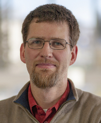
Yitian Cheng
Graduate Student, Ph.D. Candidate
B.Sc. Geophysics, University of Science and Technology of China, China
Graduate Student, Ph.D. Candidate
B.Sc. Geophysics, University of Science and Technology of China, China
Yitian uses geodetic data to characterize and interpret volcano deformation in the Aleutians.

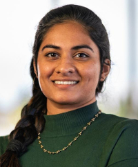
Mariah Graham
Graduate Student
B.Sc. Geology, Humboldt State University
Graduate Student
B.Sc. Geology, Humboldt State University
Mariah is interested in characterizing volcanic source processes through geodetic data and modeling.
Alumni (last known location)
- Emily Graves, Ph.D., Multi-scale InSAR Investigations of Anthropogenic and Natural Processes in the American Southwest; Grapenthin main advisor; postdoc
- Mario Angarita, Ph.D., Reanalysis and (near) Real-time Inversion of Deformation Observations at Alaskan Volcanoes; Grapenthin main advisor; Alaska Satellite Facility, UAF
- Alex Lapadat, M.Sc., Developing a Stochastic Rupture Model Catalog for Earthquakes With Magnitudes of Seven or Greater Along the Alaskan Subduction Zone; Grapenthin main advisor; Ph.D. Cand. TU Delft
- Michael Christoffersen, M.Sc., Inferring Eruption Dynamics From Seismometer-Derived Ground Tilt Measurements: A Case Study of Two End-Member Volcanic Systems; Grapenthin main advisor; Georgia Institute of Technology
- Logan Fusso, M.Sc., InSAR-Derived Thermoelastic Lava Flow Compaction Following the 2014–2015 Holuhraun Fissure Eruption; Grapenthin main advisor; Alaska Division of Geology and Geophysical Survey
- Emily Snyder, M.Sc., Modeling Deformation Processes at Mount Erebus, Antarctica, Using GPS Observations; Grapenthin main advisor; TerranearPMC
- David Polashenski, Ph.D. Ice Velocity and Basal Motion Evolution of Mountain Glaciers on Multi-decadal to Centennial Timescales, Grapenthin on committee; University of Alaska Southeast
- Pablo Saunders-Shultz, M.Sc., Deep Learning Detection and Quantification of Volcanic Thermal Signals in Infrared Satellite Data, Grapenthin on committee, USGS
- Jacob Gochenour, Ph.D. Data-Driven Modeling of a Karst Aquifer System; Grapenthin on committee; Nevada National Security Sites
- Liam Toney, Ph.D., Characterization of Geohazards via Seismic and Acoustic Waves, Grapenthin on committee; USGS Mendenhall postdoc
- Emily Morton, Ph.D., Newly Detected Earthquakes in the Cascadia Subduction. Zone, Pacific Northwest Region of the U.S, and Their Ties to Megathrust Fault Zone Heterogeneities; Grapenthin on committee; University of Utah
- Yipeng Zhang, Ph.D., Impact of Oil-Field Brine Reinjection and Continental Glaciations on Pore Pressure Evolution, Rock Failure, Brine Migration in Sedimentary Basins and Crystalline Basement; Grapenthin on committee; Texas State University
- Kimberley Haar, M.Sc., A Demonstration of Geologic and Geophysical Modeling with Legacy Seismic and Well Data; Grapenthin on committee; Alaska Earthquake Center
- Jeanine Chmielewski, graduate assistant, Administrative Controls Management, Inc.
- Natasha Graham, graduate assistant
- Katarina Vance, undergrad advisee; Michigan State University graduate student
- Shyla Kupis, undergrad advisee; University of Tasmania
- Jared Ciarico, undergrad advisee
| Last modified: January 30 2026 20:27.


